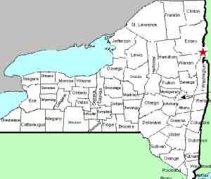
| Directions
In the village of Ticonderoga, NY 9N becomes Hague
Road from the south and Wicker Street from the north.
There is a traffic rotary at which point Hague Road
becomes Montcalm Street and Wicker Street becomes Lord
Howe Street. Drive east on Montcalm Street for
about 0.6 miles. A left on Tower Avenue will take
you to public parking. Bicentennial Park and the falls
will be just past the Tower Avenue
intersection.
|
| County: |
Essex |
| Town: |
Ticonderoga |
| USGS Map: |
Ticonderoga |
| Waterway: |
La Chute River |
| Latitude: |
N 43° 50' 56" |
| Longitude: |
W 73° 25' 16" |
| Drop: |
35' |
| Drop: |
Segmented |
| Region: |
Downtown Ticonderoga |
| Parking: |
Community Park |
| Trail type: |
Concrete walkway |
| Length of hike: |
0.1 mile |
| Difficulty: |
Easy |
| Accessibility: |
Public |
| Name: |
Common |

|
 The La Chute River serves as the outlet from Lake George to Lake
Champlain. It is entirely contained within the town of
Ticondaroga. Depending upon the source, or where you start and
end your measurement, it is only three to four miles long.
This location is the sixth and final drop in this area. The La Chute River serves as the outlet from Lake George to Lake
Champlain. It is entirely contained within the town of
Ticondaroga. Depending upon the source, or where you start and
end your measurement, it is only three to four miles long.
This location is the sixth and final drop in this area.
A number of dams have been constructed over the years
through this stretch. At most of them, there is still a
waterfall below the dam. There is still an active
hydro-electric plant at this location.
There is a very
nice waterfall below this dam. Over the years, it has had a
number of names but it has been clarified to us that the locals
refer to it as Lower Falls. Fort Ticonderoga is located
just downstream from here at the southern tip of Lake Champlain.
Years ago when the French occupied this fort, it was known as
Fort Carillon ... this is pronounced "carry on". There are
some on-line references that refer to this waterfall as the
Falls of Carillon. In fact, there are also some on-line
sources referring to this as the Falls of Clarion. It
appears that this is a mis-representation of Carillon.
The LaChute River Walk Interpretive Trail map which is
available on-line lists this as Lower Falls with an alternative
name of F Mill Dam Falls. The International Paper Company
at one time owned much of the property along here and ran a
number of mills. Several of the falls and dams acquired
names to reflect those.
Other sources mention Ticonderoga
Falls and La Chute Falls. Our local contacts indicate that
those names are not used locally but since this is the most
prominent waterfall in the village, they probably refer to it.
Finally, there is a park adjacent to this
waterfall on the grounds of the Heritage Museum and Visitor
Center known as Bicentennial Park. Some sources use the
name Bicentennial Falls, undoubtedly because of this.
Just downstream of it is a covered bridge called the Kissing
Bridge. This is one of four waterfall locations that we
know of in Northern New York with a covered bridge nearby.
The other three are
Beecher Falls in Saratoga County,
Spruce
Creek Falls in Herkimer County and
Jay Falls in Essex
County.La Chute is the outlet of Lake George and empties into Lake Champlain.
Last update: September 9, 2017
|


