| Directions
Proceed on NY 12 south out of Watertown. Just
south of the hamlet of Burrville, you will cross the Rutland
town line. In another 2.3 miles, take a right
on the Cook Road. In about one-half mile, you will
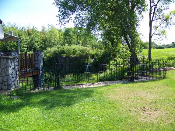
cross the Jacobs Creek. These falls are in the backyard
of a home just past this point.
|
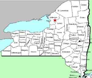
| County: |
Jefferson |
| Town: |
Rutland |
| USGS Map: |
Rutland Center |
| Waterway: |
Jacobs Creek |
| Latitude: |
N 43° 55' 08" |
| Longitude: |
W 75° 48' 15" |
| Drop: |
NA |
| Type: |
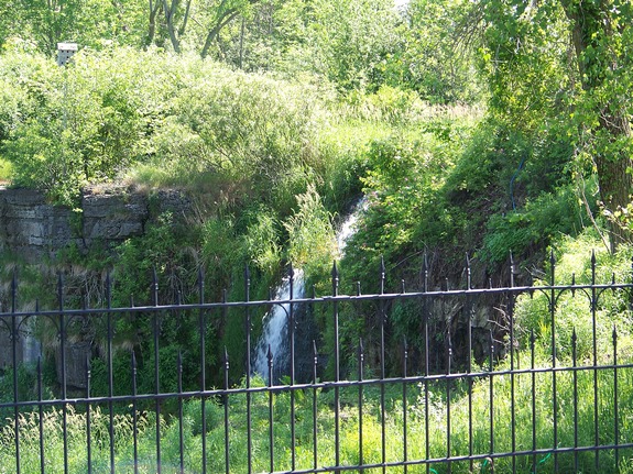
Ribbon cascade |
| Region: |
Just southeast of Watertown |
| Parking: |
NA |
| Trail type: |
NA |
| Length of hike: |
NA |
| Difficulty: |
NA |
| Accessibility: |
Private |
| Name: |
Unnamed |
|
This is one of many unnamed waterfalls in northern
New York. They are actually on the same creek that flows by
the the Burrville Cider Mill, a landmark in Jefferson County, several
miles upstream from it. I was told about these falls by an
old friend I met in college. He knew about them because he
dated a girl while in college that lived on that road. He
told me that they weren't too far off the road in a field and could
be seen from the road. What a difference 40 years makes!
They haven't moved but they are now in the backyard of a new home
that was built there. The day I visited, I stopped to get
permission from the homeowner to take some pictures and perhaps
get some additional information on the falls. No one was home
so I will stop back later to find out more. These pictures
were taken long range from the end of their driveway.
Please note that this waterfall is on private property.
New research has indicated that one might well be able to hike
up the creekbed to reach the falls but you will have to climb a
small waterfall just downstream of it. Also, as is fairly
common with many of these rural falls, at one time this location
was popular with local youth as a party spot.
Because of this, some locals may still refer to it as Party
Falls.
We originally had this posted as Jacobs
Creek Upper Falls but have subsequently discovered that a number
of waterfalls exist on this creek. In an effort to more
accurately catalog them, we have attached a new moniker to it.
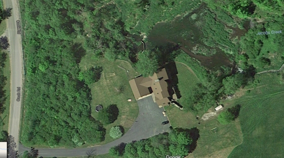
The third and final picture in our array is a Bing Maps
image showing the locations of Cook Road Lower Falls (above the
house) and Cook Road Falls (behind the house on the right of
it).
The Jacobs Creek flows into the North Branch of the Sandy Creek,
which then flows into the Sandy Creek, which eventually reaches
Lake Ontario.
Last update: November 12, 2016
|