| Directions
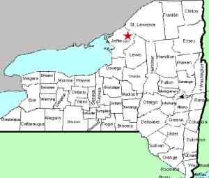
This waterfall is in the village of Philadelphia.
From the intersection of US 11 and NY 26, follow NY 26 north
for only 250 feet or so. The first left is Garden
Road. You will cross a bridge and the upper falls
will be on the left. Just past here is the Village
of Philadelphia Wastewater Collection and Treatment Facility.
|
| County: |
Jefferson |
| Town: |
Philadelphia |
| USGS Map: |
Philadelphia |
| Waterway: |
Indian River |
| Latitude: |
44° 09' 28.48" |
| Longitude: |
75° 42' 33.41" |
| Drop: |
NA |
| Type: |
Cascade |
| Region: |
In the village of Philadelphia |
| Parking: |
Roadside |
| Trail type: |
Dirt |
| Length of hike: |
0.1 mile |
| Difficulty: |
Easy |
| Accessibility: |
Public |
| Name: |
Common |

|
 This is a very interesting
location. There are four distinct drops here. Just
below a hydro dam, there is a pleasant little waterfall which we
are referring to as Philadelphia Upper Falls. You can see
this easily from Garden Road. Below this there are
three drops, which we have listed separately as
Philadelphia Right Falls,
Philadelphia Center Falls
and Philadelphia Left Falls. This is a very interesting
location. There are four distinct drops here. Just
below a hydro dam, there is a pleasant little waterfall which we
are referring to as Philadelphia Upper Falls. You can see
this easily from Garden Road. Below this there are
three drops, which we have listed separately as
Philadelphia Right Falls,
Philadelphia Center Falls
and Philadelphia Left Falls.
From the bridge on Garden Road, you can see the upper section on
your left. This is a small curtain cascade that drops about
five feet through a narrow section of the river, just below a
dam. A second drop, a slide of only about three feet, occurs
just upstream of the bridge.The Indian River flows through Black Lake. Then it joins
the Oswegatchie River which flows to the St. Lawrence River in Ogdensburg.
Last update: April 29, 2016
|


