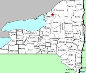
| Directions
This waterfall is in the village of Philadelphia.
From the intersection of US 11 and NY 26, follow NY 26 north
for only 250 feet or so. The first left is Garden
Road. You will cross a bridge and the upper falls
will be on the left. Just past here is the Village
of Philadelphia Wastewater Collection and Treatment Facility.
|
| County: |
Jefferson |
| Town: |
Philadelphia |
| USGS Map: |
Philadelphia |
| Waterway: |
Indian River |
| Latitude: |
44° 09' 31.54" |
| Longitude: |
75° 42' 34.91" |
| Drop: |
~25' |
| Type: |
Plunge |
| Region: |
In the village of Philadelphia |
| Parking: |
Roadside |
| Trail type: |
Dirt |
| Length of hike: |
0.1 mile |
| Difficulty: |
Easy |
| Accessibility: |
Public |
| Name: |
Common |

|
 This is a very interesting
location. There are four distinct drops here. A nice
little cascade is just
below a hydro dam. Below that the river splits into three
channels around a number of islands. This waterfall, which we
are referring to as Philadelphia Center Falls, is formed in the
center channel. This is a very interesting
location. There are four distinct drops here. A nice
little cascade is just
below a hydro dam. Below that the river splits into three
channels around a number of islands. This waterfall, which we
are referring to as Philadelphia Center Falls, is formed in the
center channel.
If you walk behind the guiderail and down the hill
by the Philadelphia Wastewater Collection and
Treatment Facility sign, bear right. Part way down the
hill, you will see this waterfall, plunging through a narrow
crevice formed by slabs of rock which appear to be tipped
sharply on its side. As the water comes through the
opening at the top, it cascades into this slab and is abruptly
diverted to the left. The riverbank at this point is made
up of fairly good sized boulders which you can easily traverse
to make your way down to water level. From here you have a
great view and photo opportunity.
This waterfall appears to be the most
forceful of the four at this site.
Even
though this is technically one waterfall location, to do justice
to all four drops, which all have their own personality, we are
providing four pages. Please also visit
Philadelphia Upper
Falls, Philadelphia Right Falls
and Philadelphia Left Falls.
The Indian River flows through Black Lake. Then it joins
the Oswegatchie River which flows to the St. Lawrence River in Ogdensburg.
Last update: April 30, 2016
|


