| Directions
Just east of the village of Indian Lake, NY 28 crosses
Lake Abanakee. Just west of this bridge there is a
road that exits north. In 3.5 miles, you will see
the Indian River on your right. This set of rapids
is Gooley Steps.
|
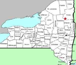
| County: |
Essex/Hamilton |
| Town: |
Indian Lake/Minerva |
| USGS Map: |
Dutton Mt |
| Waterway: |
Indian River |
| Latitude: |
N 43° 49' 16" |
| Longitude: |
W 74° 12' 3" |
| Drop: |
NA |
| Type: |
Rapids |
| Region: |
Indian Lake |
| Parking: |
Roadside |
| Trail type: |
Dirt |
| Length of hike: |
NA |
| Difficulty: |
NA |
| Accessibility: |
Unknown |
| Name: |
Common |
|
This is a named stretch of rapids on the Indian
River, just upstream of where it enters the Hudson River.
For several decades, access to this area has been limited because
it has been private. In 2013, NYS DEC acquired this property.
At 2.2 miles up this road, you will pass an area known as Indian
Head Rapids, another set of rapids. We don't know specifics
on getting to the river's edge, but we do know that this area is
now state owned and is accessible.
If anyone has pictures or information on this area, please
contact us.
The Indian River flows into the Hudson River literally at the
end of this stretch of rapids. The Hudson empties into the
Atlantic ocean in New York City.
Last update: October 27, 2015
|


