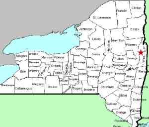
| Directions
In downtown Hudson Falls, NY 4 is Main Street.
At the corner of John Street, head west toward the Hudson
River. The road will branch. Head right and
this road will end in a "T". Take a left
on Bridge Street. You will cross the Hudson and this
becomes Saratoga County Route 27. There will be a
parking lot on the left.
|
| County: |
Washington/Saratoga |
| Town: |
Kingsbury/Moreau |
| USGS Map: |
Hudson Falls |
| Waterway: |
Hudson River |
| Latitude: |
N 43o 17' 46" |
| Longitude: |
W 73o 35' 29" |
| Drop: |
NA |
| Type: |
NA |
| Region: |
Downtown Hudson Falls |
| Parking: |
Streetside |
| Trail type: |
None |
| Length of hike: |
None |
| Difficulty: |
Easy |
| Accessibility: |
Public |
| Name: |
official |

|
Bakers Falls and Hudson Falls are one and the same,
at least as far as the waterfall is concerned. There is now,
and has been for some time, a hydroelectric dam at this location.
There is a long slide-type waterfall at the base of it..
Since the Hudson River is the county line between Washington
and Saratoga Counties at this point, the waterfall is technically
in both counties. The best view of it is from the Saratoga
County side, but we have opted to put this in Washington County
for a couple of reasons. Bakers Falls is the waterfall.
It is an officially named waterfall listed on the USGS GNIS.
That data base places it in Washington County. Hudson Falls
the community is in Washington County. Several accounts indicate
that the waterfall was named after early resident Albert Baker.
This dates back to the 1760s. In 1910, the village became
Hudson Falls, having originally been Sandy Hill. For whatever
reason, the community was name Hudson, rather than Bakers, Falls.
Perhaps this was because the waterfall was on the Hudson River.
The falls itself appears to drop about 15' over a significant
stretch below the dam. From the looks of the river around
it, this would have been quite a waterfall before the dam was built.
The Hudson River empties into the Atlantic ocean in New York
City.
Last update: october 12, 2015
|


