| Directions
This waterfall is on private property. There is
no public access.
|
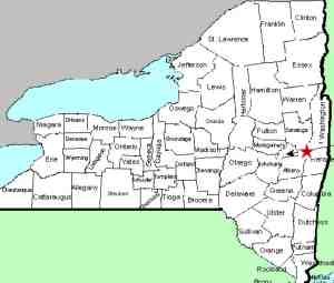
| County: |
Washington |
| Town: |
Fort Ann |
| USGS Map: |
Fort Ann |
| Waterway: |
Halfway Creek |
| Latitude: |
N 43o 25' 35" |
| Longitude: |
W 73o 29' 45" |
| Drop: |
70' |
| Type: |
Slide |
| Region: |
Northwest of Fort Ann |
| Parking: |
NA |
| Trail type: |
NA |
| Length of hike: |
NA |
| Difficulty: |
NA |
| Accessibility: |
Private |
| Name: |
Official |

|
We received an email from Gina Sabo on July 23, 2020. The
sender identified herself as the owner of
Kane Falls and asked that we edit this listing to stress that it
is on private property. We are more than happy to do that
and emphasize that there is no public access. The Halfway Creek empties into the Champlain Canal at Fort Ann.
The water from this then flows into the Head of Lake Champlain.
The flow then goes north through Canada on the Richelieu River and
empties into the St. Lawrence River.
Last update: July 25, 2020
|


