| Directions
US 11 crosses the Grass River just west of the
downtown section of Canton. There is an island at
this point and the entrance of the park will be on
the north side of the road.
|
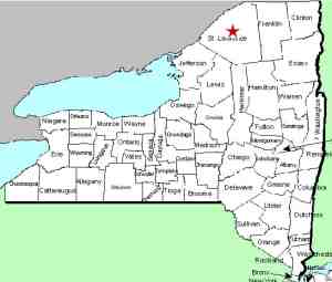
| County: |
St. Lawrence |
| Town: |
Canton |
| USGS Map: |
Canton |
| Waterway: |
Grass River |
| Latitude: |
N 44o 35' 48" |
| Longitude: |
W 75o 10' 29" |
| Drop: |
~ 10' |
| Type: |
Rapids |
| Region: |
In the village of Canton |
| Parking: |
Paved lot |
| Trail type: |
Stone paths |
| Length of hike: |
0.1 mile |
| Difficulty: |
Easy |
| Accessibility: |
Public |
| Name: |
Official |

|
 There are many waterfalls that are two parts, splitting
around an island. Most of them, however, have one name.
Cascade and Rushton Falls are two such waterfalls, but carry
separate names. Located in the village of Canton,
Cascade Falls is on the
west side of two islands in the Grass River. Rushton Falls
is on the east. The east channel splits just above Rushton Falls
and separates the islands. This split joins the west channel
at the crest of Cascade
Falls. There are many waterfalls that are two parts, splitting
around an island. Most of them, however, have one name.
Cascade and Rushton Falls are two such waterfalls, but carry
separate names. Located in the village of Canton,
Cascade Falls is on the
west side of two islands in the Grass River. Rushton Falls
is on the east. The east channel splits just above Rushton Falls
and separates the islands. This split joins the west channel
at the crest of Cascade
Falls.
There is a bit of irony regarding the names of these waterfalls.
Of the two, Cascade Falls is the larger. It is a single-drop
plunge whereas Rushton Falls is really little more than a set of
rapids. Rushton, however is an officially named waterfall,
listed on the USGS GNIS. Cascade Falls are commonly named.
A local group, known as the Grasse River Heritage has been formed.
This "is a group of Canton citizens dedicated to working with
the Canton community and local, state, and federal agencies to improve
the educational, cultural, economic, and recreational opportunities
in the Grasse River Corridor." This is according to one
of many plaques, signs and posters in this pleasant little park
they have constructed.
As you enter the parking area, you are in Heritage
Park. As you cross the footbridge, there are trails that
take you to the waterfalls. You will find several
educational signs with pictures, maps and valuable information.
There are
a number of benches to rest as you stroll around the short, very
nicely maintained area which provides great views of both falls.
Not only is the naming of the waterfalls here somewhat
unique, so is the naming of the islands. The parking area
is on Coakley Island. The trails on the other side of the
footbridge are on Falls Island. Both of these properties
make up Heritage Park and are owned and maintained by the Grasse
River Heritage. On the other side of US 11, even though it
is the same island as the parking lot (Coakley Island), it is
known as Willow Island. "The 25% or so of Willow Island
that is adjacent to Route 11 also belongs to Grasse River
Heritage" They have installed an outdoor sculpture garden
there. "The remaining 75% or so belongs to the Village of
Canton and is the site of Canton Island Park." This
information has been provided to us by Louis Tremaine, the
president of Grasse River Heritage.
Several places on this website, we have noted that depending upon which map or sign you are using, this
river is referred to as either Grasse or Grass.
Originally it was Grasse and this organization uses that
spelling in an effort to highlight the historical significance.
Somewhere along the line, when it got named on the GNIS, it
became Grass.
The Grass River flows into the St. Lawrence River in Massena,
in St. Lawrence County.
Last update: June 6, 2017
|


