| Directions
From the corner by the Post Office on US 11 in
downtown Canton, drive out Park Street past the St.
Lawrence University campus. Take a right at the
first intersection outside of town which is CR 25.
After two major intersections, you will come to the Town
Line Road on your right. Take that right and drive
to the end of this road. Take a left onto the
Pyrites-Russell Road and you will almost immediately see
a mowed area on the right with a gate at the back.
|
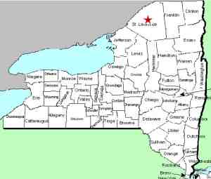
| County: |
St. Lawrence |
| Town: |
Russell |
| USGS Map: |
Canton |
| Waterway: |
Grass River |
| Latitude: |
N 44o 30' 09" |
| Longitude: |
W 75o 10' 08" |
| Drop: |
12' |
| Type: |
Rectangular Cascade |
| Region: |
South of Canton |
| Parking: |
Roadside |
| Trail type: |
Dirt |
| Length of hike: |
0.3 miles, one-way |
| Difficulty: |
Easy |
| Accessibility: |
Public |
| Name: |
Official |

|
 Harts Falls got its name from the man who owned it many years
ago. Horace S. Hart ran some kind of a mill at this location. There
are still the remnants of the foundation of the structure there
today. Based on information provided by Tom Langen,
President of the St. Lawrence Land Trust, Mr. Hart's mill and
property were foreclosed upon in 1887. He is the last Hart
known to own the property although the plantiff foreclosing
against him was Julius H. Hart. No information has been
found showing how, or if, they were related. Horace Hart
died in 1894. Harts Falls got its name from the man who owned it many years
ago. Horace S. Hart ran some kind of a mill at this location. There
are still the remnants of the foundation of the structure there
today. Based on information provided by Tom Langen,
President of the St. Lawrence Land Trust, Mr. Hart's mill and
property were foreclosed upon in 1887. He is the last Hart
known to own the property although the plantiff foreclosing
against him was Julius H. Hart. No information has been
found showing how, or if, they were related. Horace Hart
died in 1894.
For several decades, the land
surrounding this waterfall has been owned by a retired teacher
and her late husband. In September 2015, she signed 33 acres of
the area over to the St. Lawrence Land Trust which has
designated the area as "forever wild". Our kudos to Barbara
Kelly for this significant environmental action. The area is
now open to the public but according to Mr. Langen there are some changes coming.
In
collaboration with Grasse River Heritage, they will be improving
"access and recreational and educational resources." In
addition, they are asking that motorized vehicles not be used.
Please park on the roadside by this mowed area. As time and funding
permit, a parking area will be built. The gate is there
to keep motorized vehicles out. Pedestrian traffic can
pass it and you will find a mowed path. Follow this and it
will take you to the falls.
The name of this waterfall is
now official, having been added to the GNIS data base on
November 9, 2017.
The river-bed
here is smooth rock which covers most of the width of the
channel. The waterfall slides through a narrow portion as
it drops ten to twelve feet. Although we visited in
September, we were told that the waterflow was actually about
what you would expect to see throughout most of the year.
An interesting feature here are a number of pot-holes which look
like they could have been drilled in the rock, probably the
result of thousands of years of erosion. We have been told
that this has been a popular swimming hole for years, but at
this point, swimming is prohibited until they sort out the
liability issues. Fishing is allowed. The Grass River flows into the St. Lawrence River in Massena,
in St. Lawrence County.
Note: Depending upon which map or sign you are using, this
river is referred to as either Grasse or Grass.
Officially, it is Grass.
Last update: November 14, 2017
|


