| Directions
The north end of the Tooley Pond Road is less than 1000'
from the junction of CR 17 and CR 27 in the hamlet of Degrasse.
Proceed northeast on CR 27 and take a right. Five miles
down this road, the Twin Falls Hunting Club will be on the
right. Flat Rock Falls is on that property.
|
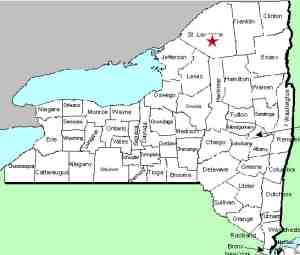
| County: |
St. Lawrence |
| Town: |
Clare |
| USGS Map: |
Degrass |
| Waterway: |
Grasse River South Branch |
| Latitude: |
N 44o 19' 06" |
| Longitude: |
W 75o 00' 28" |
| Drop: |
25' |
| Type: |
Slide |
| Region: |
South of Canton |
| Parking: |
Private club |
| Trail type: |
Dirt |
| Length of hike: |
1/4 mile, one-way |
| Difficulty: |
Easy |
| Accessibility: |
Private |
| Name: |
Official |

|
Flat Rock Falls is one of eight well-known waterfalls
on the South Branch of the Grass River which are fairly easy to
access from the Tooley Pond Road. This road, which has significant
lengths that are unpaved, connects CR 27 in the hamlet of Degrasse
to NY 3 near Cranberry Lake. It is also possible to reach
this location from the Route 3 end but our information details access
from the north.
Please note that this particular waterfall is accessible either
by boat on the river or through a private hunting camp. It
is actually one of the few areas in this region that is private
and not state-owned. My thanks are extended to Wayne Little,
a former co-worker who was caretaker of the club grounds for 12
years. He allowed us access to the falls and we took several
pictures on May 15, 2010.
It is a bit confusing as to why this hunting club is named Twin
Falls Club. It is not in the area of Twin Falls, also on this
stretch of river. It is about two miles upstream. To
the best of our knowledge, Flat Rock Falls is the only waterfall
in this immediate area. Earlier topographical maps indicate
it as "Camp Flat Rock".
The Grass River flows into the St. Lawrence River in Massena,
in St. Lawrence County.
Note: Depending upon which map or sign you are using, this
river is referred to as either Grasse or Grass.
Officially, it is Grass.
Last update: September 10, 2015
|


