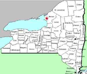
| Directions
From NYSR 12 in the hamlet of Depauville, turn onto Sylvia
Street at the corner by a convenience store. The first
right, Zang Road, will be about 3.8 miles up this road.
A short distance in, you will cross a creek, which is actually
the Chaumont River. The waterfall can be seen on the
left upstream from the road.
|
| County: |
Jefferson |
| Town: |
Clayton |
| USGS Map: |
Clayton |
| Waterway: |
Chaumont River |
| Latitude: |
N 44o 10' 30" |
| Longitude: |
W 76o 00' 52" |
| Drop: |
~ 8' |
| Type |
Ribbon cascade |
| Region: |
Northeast of the hamlet of Depauville |
| Parking: |
Roadside |
| Trail type: |
Roadside |
| Length of hike: |
Roadside |
| Difficulty: |
Easy |
| Accessibility: |
Private |
| Name: |
Unnamed |

|
You have unobstructed views of this waterfall from the highway.
You could probably get close to it as well, but the property appears
to be private, perhaps part of an Amish farm just up the road.
The Chaumont River empties into Lake ontario in the village of
Chaumont, just west of Watertown in Jefferson County.
Last update: August 5, 2015
|


