| Directions
This waterfall is west of High Falls and southwest of
the Griffin Rapids seciton of the Oswegatchie. It
can only be reached by hiking into that area. The
suggested route is on a trail which starts at the end of
Youngs Road in Star Lake. This is about 7.5 miles,
one-way. The last portion is a bushwhack.
|
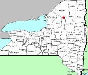
| County: |
St. Lawrence |
| Town: |
Fine |
| USGS Map: |
Five Ponds |
| Waterway: |
Buck Brook |
| Latitude: |
N 44°
03' 52" |
| Longitude: |
W 74°
59' 14" |
| Drop: |
12' |
| Type: |
Slide |
| Region: |
Southeast of Star
Lake |
| Parking: |
Roadside |
| Trail type: |
Dirt |
| Length of hike: |
7.5 miles,
one-way |
| Difficulty: |
Difficult |
| Accessibility: |
Public |
| Name: |
Unnamed |
|
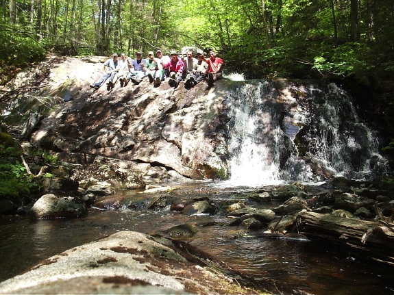
This is a two drop waterfall in a fairly remote area southeast
of Star Lake. The upper drop of about six to eight feet is
behind the people in the picture. The brook levels out for
a short period before the final drop shown.
Our thanks to
Drew Reed for the information and picture of this location.
The The Buck Brook flows into that Oswegatchie River, which flows into the St. Lawrence River in Ogdensburg,
New York.
Last update: July 2, 2017
|