| Directions
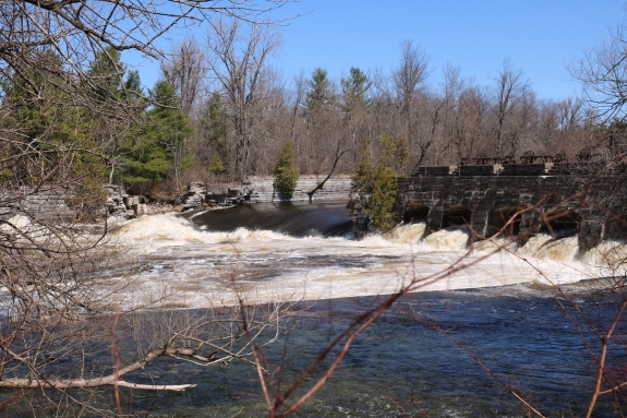
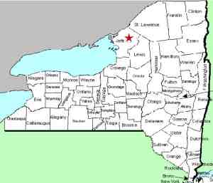
The hamlet of Felts Mills is located on NY 3, east of
Watertown. This drop can be seen from the bridge
crossing the Black River on Route 971V or from end of Island Drive in the
hamlet.
|
| County: |
Jefferson |
| Town: |
Le Ray/Rutland |
| USGS Map: |
Black River |
| Waterway: |
Black River |
| Latitude: |
N 44° 01' 23" |
| Longitude: |
W 75° 45' 463" |
| Drop: |
6' |
| Type: |
Dam |
| Region: |
Just east of the city of Watertown |
| Parking: |
Streetside |
| Trail type: |
Dirt |
| Length of hike: |
1 minute |
| Difficulty: |
Easy |
| Accessibility: |
Public |
| Name: |
Unnamed |
|
 From NY 3, enter the hamlet of Felts Mills. Island Street
is adjacent to the Post Office. It is a short dead-end
street with a barrier at the end that is within feet of the
river. From this point, you can see this drop. From NY 3, enter the hamlet of Felts Mills. Island Street
is adjacent to the Post Office. It is a short dead-end
street with a barrier at the end that is within feet of the
river. From this point, you can see this drop.
You are actually looking at the river left channel. The
land on the opposite shore is an island.
There is a dam here which does not appear to be in use. As
the pictures show, the opposite side of the channel is a short drop while on
the side closer to you, the water flows through the remains of some type of
outdated structure.
The Black River empties into Lake Ontario at the Black River
Bay, just southwest of the village of Dexter.
Last update:
February 24, 2017
|