| Directions
From the intersection of NY 12 and NY 28 in Alder Creek,
drive northeast on NY 28 to Forestport. After crossing
the Forestport Reservoir, take a right on the exit ramp.
Continue to merge on the Woodhull Road. As you go
through Forestport Station, take a right on the Bardwell
Mills Road. You will come to a corner where the Bardwell
Mills Road exits right, but you should continue straight
and you will be on the Lake Julia Road. In a little
over 1/2 mile, turn left on the Muthig Road. This
becomes the Roberts Road. You will come to a sign
on the left for the "Black River Public Fishing Stream".
Drive about 1-1/4 miles down this dirt road.
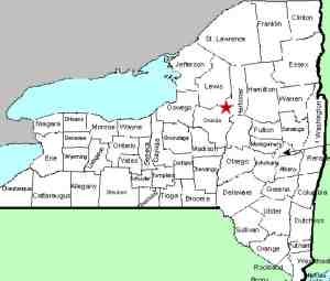
|
| County: |
Oneida |
| Town: |
Remsen/Forestport |
| USGS Map: |
Forestport |
| Waterway: |
Black River |
| Latitude: |
N 43° 23' 51" |
| Longitude: |
W 75° 08' 15" |
| Drop: |
6' |
| Type: |
Curtain cascade |
| Region: |
Southeast of Forestport |
| Parking: |
Unpaved lot |
| Trail type: |
Dirt |
| Length of hike: |
5 minutes |
| Difficulty: |
Easy |
| Accessibility: |
Public |
| Name: |
Official |

|
 As mentioned in the directions side-bar, there is a NYS DEC sign at the corner showing that this is the Black
River Public Fishing Stream. When we were there the
first time, there was also a sign identifying this road as a Jeep
Trail, Private Road. We subsequently found out that all
the land on both sides of the road was private but that the road
was state-owned. As mentioned in the directions side-bar, there is a NYS DEC sign at the corner showing that this is the Black
River Public Fishing Stream. When we were there the
first time, there was also a sign identifying this road as a Jeep
Trail, Private Road. We subsequently found out that all
the land on both sides of the road was private but that the road
was state-owned.
About 1-1/4 mile down this road, there is a parking area.
There are two trails leading from that. Either trail will
get you there, but the left trail is the most direct route to
the falls. Although
this is one of only two USGS officially named waterfalls in Oneida
County, it is not a very big one, maybe a three foot drop.
It is important to
note that these DEC trails are on the edge of state land, because
trees adjacent to the trees sporting the DEC markers, held "Private
Property No Trespassing" signs both in the upstream and
downstream directions.
Also, about 200' downstream
from the waterfall, there is another unnamed waterfall which we
have dubbed Crandall Lower Falls.
This is on private and posted land so please respect the
landowner's rights. At some point, the owners of that
property contacted us and allowed us permission to access their
land and take pictures of that drop. In 2019, they had
that property listed for sale so we do not know the current
status of the property.
The last two photos in our array are of the section of the
river upstream of the falls. At one point we were
erroneously informed that the drop we had posted here and
identified as Crandall Falls was not the actual waterfall.
It was further upstream. These shots show two sections of
minor rapids upstream. There is no additional waterfall.
NOTE: On a trip to this location in 2019, there were
problems with the Little Black Creek Bridge which is about 1/2
mile before you get to the Crandall Falls Road. It was
closed which necessitated a fairly lengthy detour. Follow
the "Roberts Road Detour" signs. We don't know how long
this will affect this area.
The Black River empties into Lake Ontario at the Black River
Bay, just southwest of the village of Dexter.
Last update: June 18, 2019
|


