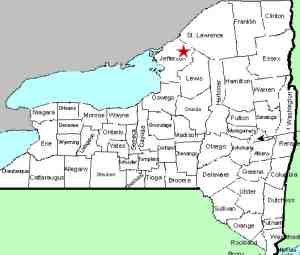
| Directions
This waterfall is located a short distance from the village
of Philadelphia. Since it is on private property,
it can only be accessed with permission from the landowner.
|
| County: |
Jefferson |
| Town: |
Philadelphia |
| USGS Map: |
Philadelphia |
| Waterway: |
Black Creek |
| Latitude: |
44o
08' 10" |
| Longitude: |
75o 42'
19" |
| Drop: |
15' |
| Type: |
Curtain cascade |
| Region: |
Due south of the village of
Philadelphia |
| Parking: |
Private |
| Trail type: |
Dirt |
| Length of hike: |
Private |
| Difficulty: |
Easy |
| Accessibility: |
Private |
| Name: |
Official |

|
 First and foremost, this waterfall is on private and posted land.
The current owners are retired educators, and fairly well known
in the area. They have owned the property since the late 1970s
and live at the location. Dale Watkins was an administrator
and his wife, Marie, a teacher, both in the Indian River Central
School District. They often welcome school, church and scout
groups and the location is frequently used for family, wedding and
graduation photos. They have been actively involved with the
foreign exchange program in the area and note that the site has
entertained hundreds of foreign exchange students and many European
and South American guests. Because of a disrespectful public,
the area is now by invitation only. They not only graciously
allowed us access to view and photograph the location, they gave
us a tour of the property and shared many historical details about
the land, the waterfall and the area in general. First and foremost, this waterfall is on private and posted land.
The current owners are retired educators, and fairly well known
in the area. They have owned the property since the late 1970s
and live at the location. Dale Watkins was an administrator
and his wife, Marie, a teacher, both in the Indian River Central
School District. They often welcome school, church and scout
groups and the location is frequently used for family, wedding and
graduation photos. They have been actively involved with the
foreign exchange program in the area and note that the site has
entertained hundreds of foreign exchange students and many European
and South American guests. Because of a disrespectful public,
the area is now by invitation only. They not only graciously
allowed us access to view and photograph the location, they gave
us a tour of the property and shared many historical details about
the land, the waterfall and the area in general.
This is a very interesting area. Often you would have to
hike a significant distance to find this kind of beauty and tranquility.
This gem, however, is about a mile from the village of Philadelphia,
two miles from the Fort Drum Army Base and less than 500 feet from
the highway. They maintain a series of trails there, including
picnic tables and concrete/wooden benches. This is very much
a private nature trail/picnic area.
Distant views of the falls can be had from County Route 29, just
south of the end of Belile Road. We often note that in private
property situations, it may be possible to canoe/kayak up the waterway
to the falls. In this case, even that is not an option.
The owners' land extends around the corner and about 50 to 60 feet
up the Belile Road. Beyond this, the adjacent property is
also private. Permission to access the creek at this point
would have to be granted by the landowner or else one would have
to find a point further downstream that is public. We don't
know if such a point exists. In addition, there is an interesting
clause in their deed. Although they note that they "cannot
own the creek", the deed states that they own "the land
under the water to the low mark on the other side". If
you stay in your boat, you are safe, but if you get out and stand
in the water, you will be trespassing.
This waterfall is named after Cadwallader Child, who was a surveyor
and informal leader of a group that came from Pennsylvania and settled
this area in the very early 1800s. The name of this waterfall is
now official, having been added to the GNIS data base on
November 9, 2017.
Immediately adjacent to the property is a new cemetery which
has been dedicated as Childs Falls Sunrise Cemetery. The cemetery
is upstream from the waterfall, so it is not visible from there.
The Black Creek flows into the Indian River just upstream from
the village of Philadelphia. The Indian flows through Black
Lake and joins the Oswegatchie River which flows to the St. Lawrence
River in Ogdensburg.
Last update: November 14, 2017
|


