| Directions
Take the Belfort Road from the village of Croghan toward
Belfort. Turn right on the Effley Falls Road, just
before reaching the hamlet of Belfort. In 2.5 miles,
there will be a road exiting to the left. This leads
to the power plants at Effley Falls and Elmer Falls.
|
| County: |
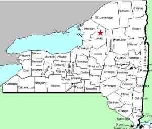
Lewis |
| Town: |
Croghan |
| USGS Map: |
Belfort |
| Waterway: |
Beaver River |
| Latitude: |
N 43o 55' 37" |
| Longitude: |
W 75o 17' 18" |
| Drop: |
~25' |
| Type: |
Slide |
| Region: |
East of Croghan |
| Parking: |
NA |
| Trail type: |
NA |
| Length of hike: |
NA |
| Difficulty: |
NA |
| Accessibility: |
Private |
| Name: |
Official |

|
An officially named waterfall, a hydro-electric
facility has been at this location for many years. There is
still a waterfall at the base of this dam. Directions to this
facility are not really of value because when you reach the road
to the plants, you will encounter gates and posted signs and can
not enter. It appears that the only access is by permission
from the power company or on the river.
We will have to be content with our view of it from
Bing Maps.
The Beaver River flows into the Black River, which empties into
Lake Ontario at the Black River Bay, just southwest of the village
of Dexter.
Last update: July 28, 2015
|


