| Directions
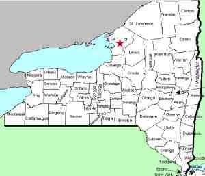
This waterfall is located on an unnamed creek that flows
into Beaver Meadows, a swamp/wetlands area southwest of the city
of Watertown. It is on private property.
|
| County: |
Jefferson |
| Town: |
Watertown |
| USGS Map: |
Watertown |
| Waterway: |
Unknown waterway |
| Latitude: |
N 43° 57' 36" |
| Longitude: |
W 75° 57' 27" |
| Drop: |
25' |
| Type: |
Square Block |
| Region: |
Just southwest of the city of Watertown |
| Parking: |
Roadside |
| Trail type: |
Creekside |
| Length of hike: |
1/4 mile, one-way |
| Difficulty: |
Easy |
| Accessibility: |
Private |
| Name: |
Official |

|
 We had several inquiries about this waterfall on
our Facebook page. After posting some questions for users,
a young man from the Carolinas that grew up in Watertown stepped forward and told us that his dad knew the owner.
After getting in touch with him, he took us and introduced us to
the owner and guided us in to the waterfall. Small world!After our hike, we were speaking to the owner and discovered that
we graduated from high school together! We had several inquiries about this waterfall on
our Facebook page. After posting some questions for users,
a young man from the Carolinas that grew up in Watertown stepped forward and told us that his dad knew the owner.
After getting in touch with him, he took us and introduced us to
the owner and guided us in to the waterfall. Small world!After our hike, we were speaking to the owner and discovered that
we graduated from high school together!
The area around this location has become very overgrown.
The best way to access the falls is to hike down the creek and then
walk down the step like drop that forms the falls. We stress
the fact that we know the owners and had permission to visit but
remember that this is on private property. Respect the landowners'
rights and property.
As the pictures show, this is basically a square block.
A few feet in at the crest, there are about 5 steps totaling three
or four feet. The main plunge displays the layers of rock
that dominate this area. Since you can, and we have,
climbed this falls, one might argue that it is a step-type
falls. You have to draw the line somewhere. We are
calling it a block because the steps are so quick in succession that
you can't simply walk up and down them, like stairs. You
do have hang on as you go and scale the descent.
Technically, the waterway containing this waterfall is unnamed.
It is one of many streams and creeks that drains this area.
Beaver Meadows empties into the Mill Creek which flows into Lake
ontario near Sackets Harbor.
Last update: July 16, 2017
|


