| Directions
As you head north from the village of Keeseville
toward the Ausable Chasm attraction, you will find signs
for the Alice Falls Hydro Project on your right.
Be aware that they are somewhat tucked in off the road
and you might not see them until you are just about on
them. Coming from the north, this entrance is only
0.3 mile from the Ausable Chasm attraction.
|
| County: |
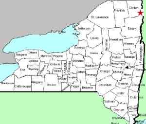
Clinton/Essex |
| Town: |
Ausable/Chesterfield |
| USGS Map: |
Keeseville |
| Waterway: |
Ausable River |
| Latitude: |
N 44° 31'
09" |
| Longitude: |
N 73° 27' 54" |
| Type: |
Rectangular cascade |
| Drop: |
~35' |
| Region: |
Just north of Keeseville |
| Parking: |
Unpaved lot |
| Trail type: |
Dirt/rock |
| Length of hike: |
0.1 mile |
| Difficulty: |
Easy |
| Accessibility: |
Public |
| Name: |
Official |

|
 Alice Falls is a beautiful waterfall
within a short walk off New York State Route 9, just north of Keeseville.
There is a parking area soon after you enter, or you can drive a
short distance on this dirt road between the hydro facility on your
right and a trailer on the left. There is another parking
area further back on your left and a fishing area on your right.
Walk down the hill and you will come to the river bank where you
descend a natural rock stairway to a flat area at the base of the
falls. Alice Falls is a beautiful waterfall
within a short walk off New York State Route 9, just north of Keeseville.
There is a parking area soon after you enter, or you can drive a
short distance on this dirt road between the hydro facility on your
right and a trailer on the left. There is another parking
area further back on your left and a fishing area on your right.
Walk down the hill and you will come to the river bank where you
descend a natural rock stairway to a flat area at the base of the
falls.
Although there is now a hydro facility here, the waterfall still
encompasses half of the width of the river. Even in the later
summer months, it is an impressive sight. In the spring, when
the Ausable's East and West Branches are draining the melting snow
in the Adirondacks, this section of the river takes everything from
above. The water coming down through here is intense.
This location is on the Essex/Clinton County Line. While
the viewing access is on the Clinton County side of the river, from
a purist point of view, one might say that the waterfall is actually
in Essex County because the falls spans the Essex half the river
while the dam is on the Clinton County side. On our county
listing, we have listed it in Essex County because more of it is
on that side.
We have been unsuccessful in our research to determine the source
of the name of Alice Falls. We do know that Alice Falls
was originally known as Little Falls. We have been provided with a published article
that indicates that it might have been Alice Falls as early as 1823.
Several parties are now researching this to determine when this
happened and who Alice was.
Disclaimer: on August 21, I received a
series of emails inquiring about nude swimming at Alice Falls.
It turns out that the website of a nudist club in that area
promotes this as a nudist swimming hole. Furthermore, they
refer to this webpage for directions. Please be advised
that we have nothing to do that with that website or that club.
We look at this as an unauthorized reference to our site and to
the best of our knowledge, nudism is not tolerated at this
location.
The Ausable River empties into Lake Champlain in the town of
Peru.
Last update: August 21, 2017
|


