| Directions
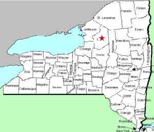
This waterfall is located on NY 26 between the
village of Lowville and the hamlet of Deer River.
It is just down the hill from the Arthur Road
intersection and is visible off the west side of the
highway.
|
| County: |
Lewis |
| Town: |
Lowville |
| USGS Map: |
West
Lowville |
| Waterway: |
Unnamed waterway |
| Latitude: |
N 43°
50' 45" |
| Longitude: |
W 75°
31' 45" |
| Drop: |
12' |
| Type: |
Multiple
curtains |
| Region: |
North of
Lowville |
| Parking: |
Roadside |
| Trail type: |
Roadside |
| Length of
hike: |
Roadside |
| Difficulty: |
Easy |
| Accessibility: |
Private |
| Name: |
Unnamed |

|
This location is on private property, but it doesn't
really matter because you can see it from the roadside.
The waterfall is unnamed and since the stream is as well, we
can't use our general process of giving it a name based on the
waterfall. Although it is not on the Arthur Road, we are
using this name because it is off NY 26 just down the road from
the intersection of that town road.
The waterfall is about seven drops. The furthest drop
that can be seen is about 3' followed by three more drops.
The next two are only a foot or so each and the third one
another 3 footer. The creek then goes through a culvert
under the highway and when it exits the other side, you can see
another pair of small drops. As the photo shows, there is
a short span between each of the drops.
This waterway has multiple points of origin and flows into a
large swamp. The East Road is a short distance east of NY
26 and runs parallel to it. This swamp is located between
the East Road and Black River, which is a bit further east.
This waterway is drained by a number of small creeks which all
lead into the Black River. This flows into Lake Ontario at
Dexter in Jefferson County.
Last udpate: June 12, 2017
|


