| Directions
From NY 12 in the village of Boonville, driving
east/northeasterly on either East Schuyler Street or
Cemetery Street will take you to your destination.
These become Sargeant Road and Moose River Road,
respectively. About 1/4 mile after leaving the
village, these two converge. Just back from this
intersection on Sargeant Road you will find the Black
River Canal towpath.
|
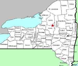
| County: |
Oneida |
| Town: |
Boonville |
| USGS Map: |
Boonville |
| Waterway: |
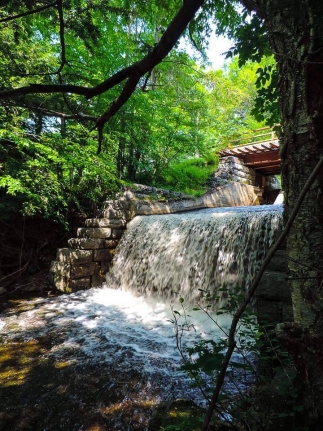
Unnamed stream feeding the Mill Creek |
| Latitude: |
N 43° 29' 42" |
| Longitude: |
W 75° 19' 05" |
| Drop: |
10' |
| Type: |
Rectangular Block |
| Region: |
Just northeast of Boonville |
| Trail type: |
Dirt |
| Length of hike: |
1/4 mile, one-way |
| Difficulty: |
Easy |
| Accessibility: |
Public |
| Name: |
Unnamed |
|
 Walk northerly (away from the village of Boonville) on the
towpath. In about 1/4 mile, you will come to a bridge that
is crossing this unnamed stream.
This waterfall is just downstream from this bridge. You
should be able to easily make your way to the stream bank below
the falls. Walk northerly (away from the village of Boonville) on the
towpath. In about 1/4 mile, you will come to a bridge that
is crossing this unnamed stream.
This waterfall is just downstream from this bridge. You
should be able to easily make your way to the stream bank below
the falls.Our thanks to Stacy Brown for submitting these pictures and
access information.
This stream joins the Mill Creek just downstream from here.
The Mill Creek flows into the Black River a short distance from
that point. The Black empties into Lake Ontario just in
Dexter in Jefferson County.
Last update: November 7, 2017
|