| Directions
From the community of North Hudson,
proceed north on US 9. Look for the West Mill
Brook trailhead on the left.
|
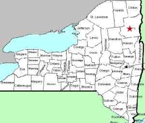
| County: |
Essex |
| Town: |
North Hudson |
| USGS Map: |
Mt Marcy |
| Waterway: |
West Mill
Brook |
| Latitude: |
N 44°
02' 02" |
| Longitude: |
W 73°
45' 33" |
| Drop: |
80' |
| Type: |
Tow-tiered
ribbon cascade |
| Region: |
NY 9, northwest
of North Hudson |
| Parking: |
Unpaved lot |
| Trail type: |
Dirt |
| Length of
hike: |
9 hours, round-trip |
| Difficulty: |
Moderate to
difficult |
| Accessibility: |
Public |
| Name: |
Unnamed |
|
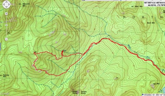
This waterfall is located
in a fairly remote section of Essex County. Portions of the
hike involve significant bushwhacking. Since it is not an
established trail, we have provided a topographical map with the
trail indicated. Our thanks to Michael Arthur of offonadventure.com.
He has provided the access directions, the information about this
hike and all of the pictures on this page.
The first 1.1 miles of this trail are passable in a 4-wheel-drive
vehicle. Those without that conveyance may opt to walk this
section. Within a few hundred yards from the trailhead, you
will have to drive across/wade through West Mill Brook. It
is often only ankle deep, but may be deeper in the spring or after
heavy rain. When you reach the gate, follow the West Mill
Brook Jeep Road for another 2.4 miles to the end. At this
point, you are about one mile from the waterfall. Cross the
brook, turn southeast and follow the western side of the brook.
You will soon pass a beaver dam. Continue to follow the brook
and you will come to a drainage section that will lead to the waterfall.
Climb the left side of the drainage. You will come to a deep
ravine in the drainage. Stay high on the left. The bushwhacking
will become difficult from here on. The falls are about halfway
up the slope to Hill 1066 on the southeast shoulder of Macomb Mountain.
As you approach that point, cut across the slope and head toward
the north toward the drainage. You should reach the brook
in the vicinity of the waterfall.
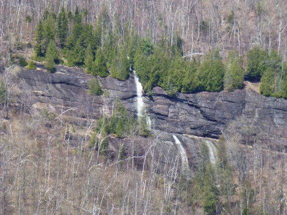
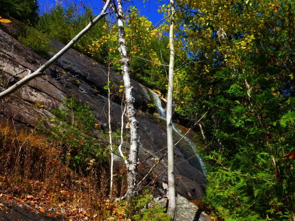
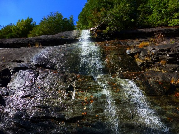
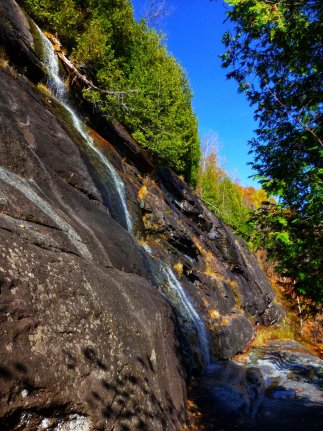
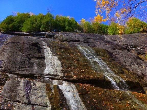
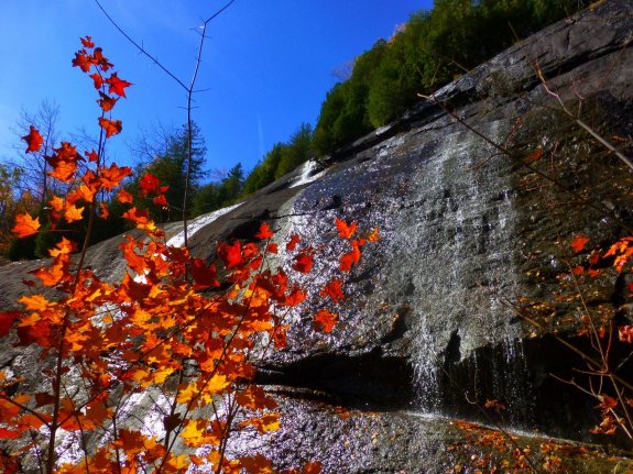
This waterfall is labeled simply as "Falls" on topographical
maps. It is a spectacular, two-tiered falls. These pictures
were taken in october 2013. There is probably significantly
more water flowing in the spring. At about 50', the upper
section is the larger of the two drops. It falls onto a ledge,
flows across the rock and then plunges over the edge for the second
drop of about 30'.
This is a significant hike. over the 4.5 miles, there is
a total vertical gain of about 2600 feet For a complete report
on this trip, and additional pictures, read Michael Arthur's blog
at
offonadventure.com. A serious and dedicated hiker, Mike
operates this blog, which contains many trip reports and pictures
of remote locations in the Adirondacks and New England.
The West Mill Brook flows into the Schroon River about four miles
north of North Hudson. The Schroon then flows south, through
Schroon Lake, and then continues its journey to the Hudson River
just outside of the village of Warrensburg. The Hudson flows
into the Atlantic Ocean in New York City.
Last update: October 12, 2016
|