| Directions
From the intersection of NY 365 and NY 8,
north of Ohio, New York, proceed west on NY 8 for about 5.5
miles. On the left (north side of the road), there
is a rest area/park. This is just before the highway
crosses the West Canada Creek.
|
|
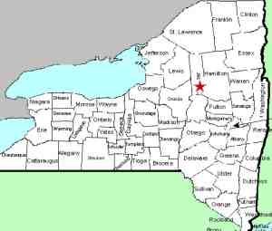
County: |
Herkimer |
|
Town: |
Ohio |
|
USGS Map: |
Morehouseville |
|
Waterway: |
West Canada Creek |
|
Latitude: |
N 43° 23' 45" |
|
Longitude: |
W 74° 51' 37" |
|
Drop: |
4' |
|
Type: |
Curtain Slide |
|
Region: |
West-central Herkimer County |
|
Parking: |
Paved lot |
|
Trail type: |
Dirt |
|
Length of hike: |
1 minute |
|
Difficulty: |
Easy |
|
Accessibility: |
Public |
|
Name: |
Unnamed |
|
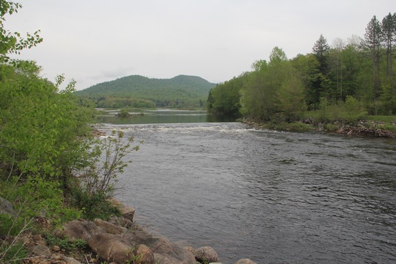
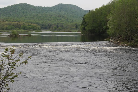
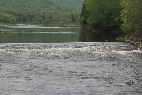
This is an
unnamed, fairly insignificant waterfall within site of NY 8.
It is not indicated on topographical maps and might well be considered
rapids rather than a waterfall, except that there is only one drop.
It is a quick slide of four to five feet.
The site is home to a small rest area with a paved circular road.
A kiosk there highlights information on the area.
The West Canada Creek empties into the Mohawk River, which then
flows into the Hudson before reaching the Atlantic Ocean.
Last update: October 12, 2016
|