| Directions
From US 11 in Brasher Falls, take CR 53 north.
A little over 1-1/4 mile after crossing the Munson Road
in Brasher Center, take a right on the Hastings Falls
Road. This road will take you very close to the
river and the waterfall will be on the left.
|
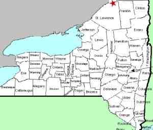
| County: |
St. Lawrence |
| Town: |
Brasher |
| USGS Map: |
Raquette River |
| Waterway: |
St. Regis
River |
| Latitude: |
N 44°
52' 50" |
| Longitude: |
W 74° 45'
59" |
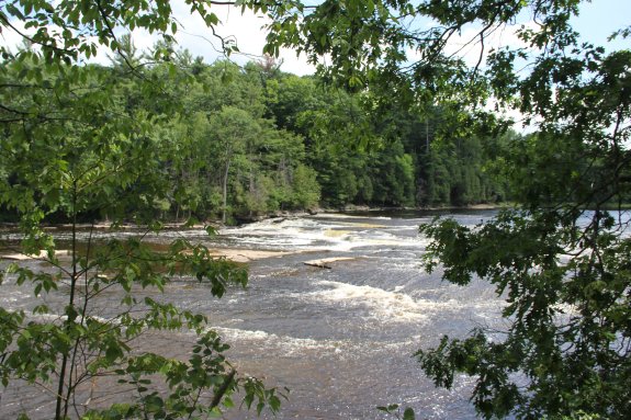
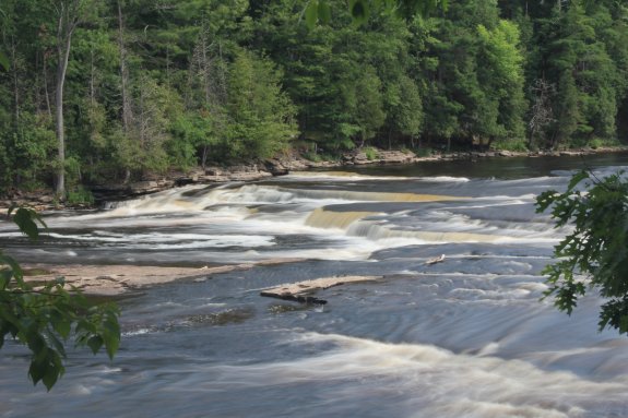
| Drop: |
8' |
| Type: |
Rectangular Block |
| Region: |
Just north
of the hamlet of Brasher Falls |
| Parking: |
Roadside |
| Trail type: |
Dirt |
| Length of
hike: |
150' |
| Difficulty: |
Easy |
| Accessibility: |
Public |
| Name: |
Common |
|
 First
of all, Hastings Falls Road is both an unpaved road and is
marked as private. Property records in St. Lawrence County
note that the first section of the road is part of the parcel on
the right of this road and the remainder is part of the property
on the left, so it is, in fact privately owned. First
of all, Hastings Falls Road is both an unpaved road and is
marked as private. Property records in St. Lawrence County
note that the first section of the road is part of the parcel on
the right of this road and the remainder is part of the property
on the left, so it is, in fact privately owned.
Having
said that, our information also indicates that there is a parcel
of land that accesses the waterfall where the primary owner is listed as "New
York State Reforestation". It is our understanding, to the
best of our knowledge, that in cases like this, the access road
is available as a right-of-way to the public, state owned land.
As you enter this area, the road will turn 90° to the right.
At that point, on your left, there is a wooded area. This
is the public land. Walk a very short distance to the
river and you will see the waterfall. Please note that
your vantage point is several feet above the water level.
Since the view of the falls is clear at that point, we did not
look for ways to descend to the bank, but it is likely possible.
If you travel a few feet further down the road, you
encounter camps on the river level where the bank is readily
accessed. This does necessitate crossing private land,
however, so we do not endorse that route.We researched a
number of on-line mapping websites and they do not all agree on
the roads in this area. Note that the information provided
in our directions side-bar is accurate.
For those not interested in questioning the private property
issue, it is also possible to access this drop from the other
side of the river. Travel a bit further on CR 53.
After crossing the St. Regis River, the first right will be the
Myers Road. A short distance down this road and you will
come to a right on the Vice Road. In 1.5 miles, the
waterfall will be on the right. All of the property in
this area, on this side of the river, is state-owned. You
can also access Flat Rock on this route, a long-time popular
swimming hole about 1300 feet downstream from Hastings Falls.
This is roughly across from the junction of another road which
is unnamed. All of these roads are undeveloped.
The St. Regis River flows into the St. Lawrence River almost
on the US/Canada border a few miles northeast of Massena, New York.
Latest update: October 7, 2022
|