| Directions
This waterfall is located off the Lee Road in the town
of Ellisburg but is on private property.
|
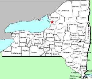
| County: |
Jefferson |
| Town: |
Ellisburg |
| USGS Map: |
Adams |
| Waterway: |
South Sandy Creek |
| Latitude: |
N 43°
45' 25" |
| Longitude: |
W 76°
04' 53" |
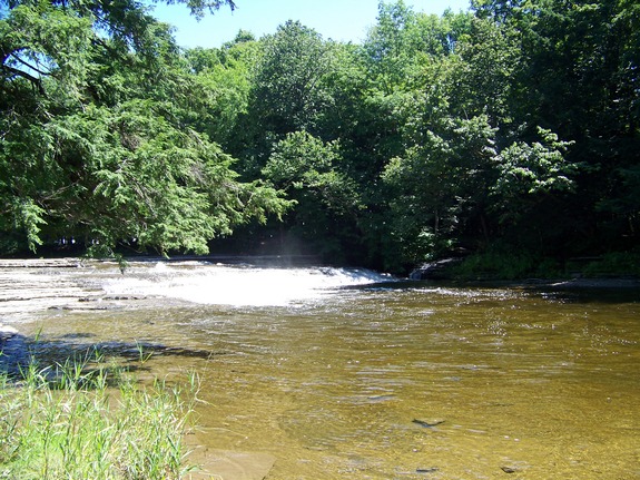
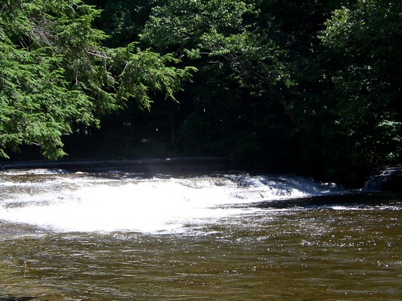
| Drop: |
~ 6' |
| Type: |
Slide |
| Region: |
South of Adams |
| Parking: |
NA |
| Trail type: |
NA |
| Length of hike: |
NA |
| Difficulty: |
NA |
| Accessibility: |
Private |
| Name: |
Charted/Unnamed |
|
Finding these falls turned
out to be a very interesting experience. A resident near the
Upper South Sandy
Creek Falls told us that the land around these falls
was owned by a local farmer. We went to that farm to be told
that the area is owned by a different farmer. We went to his
farm and he graciously granted us access to the area. After
following his directions, we weren't able to locate the falls, so
we went back. Having ties to a dairy farming family, we didn't
want to bother him because we knew he had a lot of work to do.
We knew he had thousands of bales of hay to put up and untold number
of cows to milk. His response was "I'll take you there."
We soon realized why we couldn't find it on our own. We
literally followed him through a soybean field to reach a camping
area that the family had set up on the river bank by the falls.
These falls can obviously be accessed by canoe or kayak on the river,
but since they are on private land, please respect the landowner's
property and get permission if you want to gain access by land.
We would like to thank Farmer Doug Brown for allowing us access
and for guiding us there.
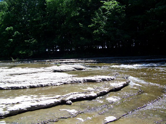
Noted simply as "falls" on these maps, they are technically
unnamed and have no common local name. We have tentatively
called them this because there are two waterfalls that we know of
on the South Sandy Creek and these are the further downstream.
These pictures were taken in the summer during a relatively dry
period. In the spring there is a much heavier flow.
We suspect that this location could be accessed by canoe or kayak
by putting in at the bridge on Log London Road, just downstream,
near its intersection with the Lee Road. This method is just
a theory and has not been tested
The South Sandy Creek flows into Lake Ontario.
Last update: September 30, 2016
|