| Directions
In Cadyville, proceed west on NY 3. Just after Saranac,
take a left on the Hardscrabble Road/CR 31. Take a
right on Soper Street and follow this. This merges onto
Pup Hill Road just before reaching a bridge, closed to
vehicular traffic, when this gets back to NY 3. Just
before this bridge, there is a dirt road to the left.
Proceed down this road to the coordinates N 44.6339428,
W 73.7582305. From there, bushwhack west to the falls.
|
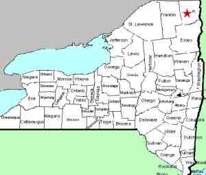
| County: |
Clinton |
| Town: |
Saranac |
| USGS Map: |
Moffitsville |
| Waterway: |
Saranac River |
| Latitude: |
N 44°
37' 58" |
| Longitude: |
W 73°
45' 37" |
| Drop: |
70' |
| Type: |
Ribbon cascade |
| Region: |
Off NY 3 between
Saranac and Redford |
| Parking: |
Roadside |
| Trail type: |
Dirt |
| Length of
hike: |
< 1000' |
| Difficulty: |
Moderate |
| Accessibility: |
NA |
| Name: |
Common |
|
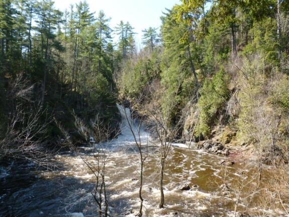
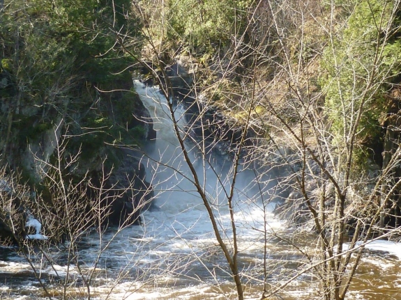
This waterfall is just downstream from the High Falls Power
Dam location.
Our information was provided by a contributor who wished to
remain anonymous. The directions in the side-bar was his
route of access. Although there are no marked trails to the waterfall, the hike
appears to be only about 1000 feet, so the bushwhack shouldn't be
too bad.
Please be aware
that, according to maps, the Pup Hill Road is
actually a loop that comes into NY 3 at two different locations.
One is on the east end of the village of Redford. The other
is another 2.5 miles northeast, closer to the hamlet of Moffitsville.
You want the latter of these two locations. Since the bridge
is closed, if you are coming from the west, you could also follow
that end of the Pup Hill Road to this bridge. Also, at the
eastern end by this bridge, the Soper Road splits off the Pup Hill
Road. Some maps call the extreme end of this where it comes
out to NY 3 as Pup Hill Road and some maps call it Soper Road.
Our contributor has also indicated that it may be possible to
park by the river at the end of the Pup Hill Road and hike up the
riverbank to the falls. Images from Bing Maps do show homes
in this area on the west side of the river, so this well may be private property. No
homes can be seen on the other shore, so this might be what he
is referring to. The area where the falls are located is
owned by New York State Electric and Gas (NYSEG), an electric
and gas utility company.
At the expense of stating the obvious, our contributor got in
there, so there must be a passable route! We
visited this area in June 2015 with the intention of doing this
but between the heavy rain at the time and an injury sustained on
a lengthy hike the day before, we were forced to abort the mission.
If anyone has any additional information on this waterfall or
pictures of it, we would like to
hear from you.
The Saranac River empties into Lake Champlain in the city of
Plattsburgh.
Last update: February 10, 2024
|