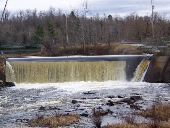
| Directions
Proceed east on NY 58 from the village
of Gouverneur. You will pass through the town
of Fowler. As you cross the town line into Edwards,
look for the Talcville Road exiting on your left.
It will be about 1.3 miles from the town line and is
the first left. Travel down this road for about
a mile where you will cross the Oswegatchie. This
dam is on the left just downstream.
|
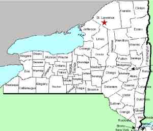
| County: |
St. Lawrence |
| Town: |
Edwards |
| USGS Map: |
Edwards |
| Waterway: |
Oswegatchie River |
| Latitude: |
44° 18' 30" |
| Longitude: |
75° 18' 32" |
| Drop: |
25' |
| Type: |
Dam/Historical |
| Region: |
Southwest of Edwards |
| Parking: |
Roadside |
| Trail type: |
Dirt/roadside |
| Length of hike: |
1 minute |
| Difficulty: |
Easy |
| Accessibility: |
Private/roadside view |
| Name: |
Common |
|
In the early days of this
website, many hydro-electric power dam locations were included.
The decision was eventually made to only include hydro projects
that were known to have once been waterfalls. As a result,
the Talcville Dam was deleted.
During research for a website project for the
Edwards Historical
Society on the community of Talcville, it was discovered that
the original iron furnace, and later a sawmill in Talcville were
located at Butternut Falls. There is no known waterfall in
that area today, Butternut or otherwise, and no one, even the eldest
citizens of the area ever remember a Butternut Falls. The
original dam at this site was built in 1909, which pre-dates the
memory of anyone alive today. One theory is that these
falls were at the site of what is now the Talcville Dam.
This is just a theory. There are two other waterfalls
downstream of here that may have been Butternut Falls.
They are Hailesboro Falls and Dodgeville.
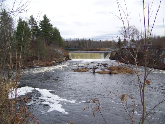
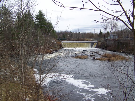
Downstream views of this area can be had by continuing over the
bridge and turning left on the Ames Road. This seasonally
maintained dirt road will loop around a small hill and come back
to the river's edge just downstream of the dam.
The hamlet of Talcville was once a booming area. Known
as Freemansburgh when it was formed in 1830, it was originally named
for Captain Alfred Freeman, an early settler who tried to establish
iron mines there. Iron mining failed after about 20 years
but several years later, talc mining became the prominent industry
at that time. It was renamed Talcville in 1889 because of
this. From the 1880s through the late 1970s, it was the largest
talc producing area in the world. In the latter half of the
twentieth century, a number of family farms were active within one
or two miles of the hamlet. Today the mines and farms are
gone. This hydro facility and the Hollow Dam project located
about two miles away on the Oswegatchie's West Branch are the only
industries remaining. Primarily a residential area, it is
now a quiet, sleepy country road.
The Oswegatchie River flows to the St. Lawrence River in Ogdensburg.
Last update: June 2, 2020
|