|
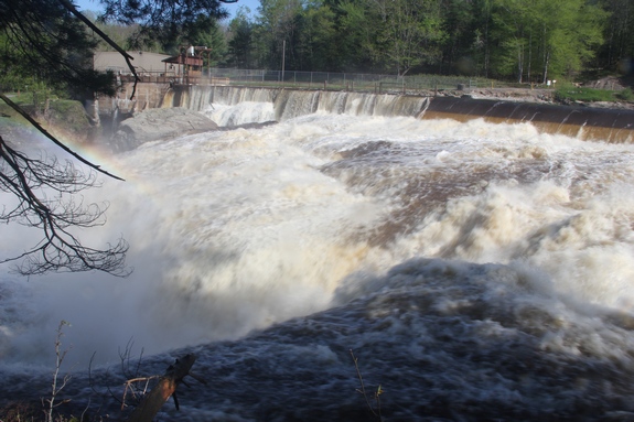
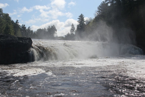
 The hydroelectric facility at this location is identified as
Lyons Falls Hydroelectric Kosterville Site. Behind the plant
there is a waterfall below the dam. The most popular name
of this drop is Magilla, a name given by the whitewater community. The hydroelectric facility at this location is identified as
Lyons Falls Hydroelectric Kosterville Site. Behind the plant
there is a waterfall below the dam. The most popular name
of this drop is Magilla, a name given by the whitewater community.
Although there has been quite a bit of confusion on our part
about this location, we have come to realize that before the hydro
dam and before the popularity of whitewater kayaking, this waterfall
was originally known as Kosterville Falls.
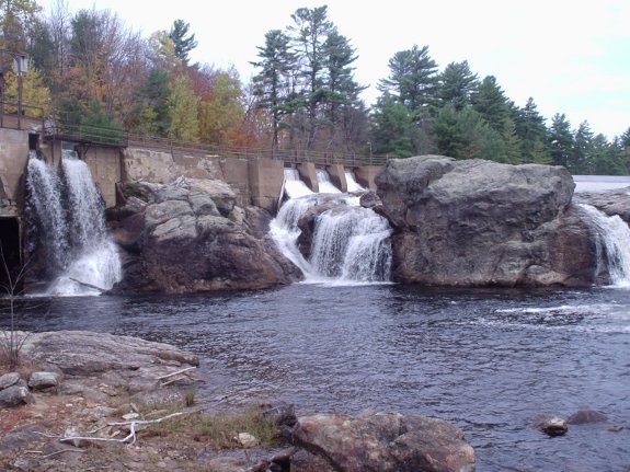
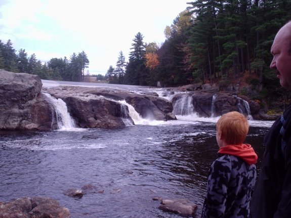
Our confusion stemmed from the fact that we have found online
references that identified Kosterville Falls as the river right
portion of the Gouldtown Hydro Site just downstream of this location.
Other references called this location Kosterville Falls. Goulds
Mills was a community on the south side of the river and Kosterville
was on the north side. Neither of these communities exist,
per se, today.
After much research and conversations with a number of local
residents who have spent their entire life in this area, we have
determined that Magilla and Kosterville Falls are most likely one
and the same and the entire span of the river at the Gouldtown Site
is in fact, Goulds Mills Falls.
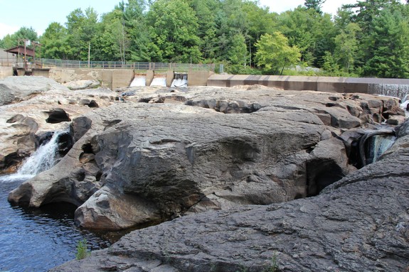
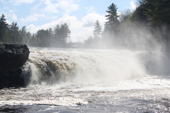
We have pictures of this drop from both sides of the river.
The property on the south bank is private but, as personal friends,
we were granted permission to access it. We have photos from
August 2011 when it was particularly dry and others from May 2014
which followed one of the wildest winters on record. In addition,
two inches of rain fell the day before we were there.
It is interesting to note that the water level through this stretch
makes a dramatic impact on the appearance of each section.
High water and low water comparisons almost make this look like
a different waterfall!
The Moose River flows into the Black River just a few miles downstream
from this location in Lyons Falls. The Black empties into
Lake Ontario in the Jefferson County community of Dexter.
Last update: April 25, 2017
|