| Directions
Just east of the hamlet of Pitcairn, which is east of
Harrisville, look for the Jayville Road, which exits
south from NY 3. Coming from the east on Route 3,
it is 3.9 miles from the intersection of St. Lawrence
County Route 23. About 2-3/4 miles up this road,
it crosses some railroad tracks. At this point,
take the right onto Powell Road. In about 800
feet, take a left onto Dodge Road.
|
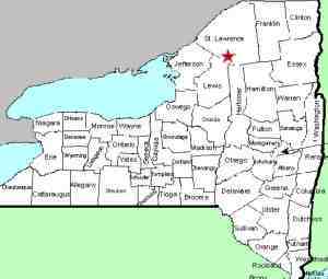
| County: |
St. Lawrence |
| Town: |
Fine |
| USGS Map: |
Fine |
| Waterway: |
Gulf Stream |
| Latitude: |
N 44o 08' 32" |
| Longitude: |
W 75o 10' 31" |
| Drop: |
35' combined two falls |
| Type: |
Ribbon cascade |
| Region: |
Off NY 3 between Harrisville and Fine |
| Parking: |
Dirt lot |
| Trail type: |
Dirt/rock |
| Length of hike: |
2 miles |
| Difficulty: |
Difficult |
| Accessibility: |
Public |
| Name: |
Common |
|
We have had this page for a few years but recently were made
aware of additional information from a contributor and have
made some changes based on the information he has provided.
Our thanks to Benjamin Fowler for the pictures and the
following account.
From the point noted at the end of
the directions side-bar, the road is privately maintained.
This road does terminate in a parking area on forever
wild state land. The areas off the road and around the
road itself are heavily and well posted. It would not be
advisable to take this road in a small passenger car without
all wheel drive or four wheel drive.
If you do drive further expect a rough road and a homemade
bridge. If you walk from the corner of Powell Road,
expect an extra mile to get to the trail head. After
one mile on Dodge Road you will see a gate for private
property. To the left of this, there is a small
parking area on state land. From here you will see a
small trail. This is not well maintained. It
ends in blowdown not far from here, and you may pick up
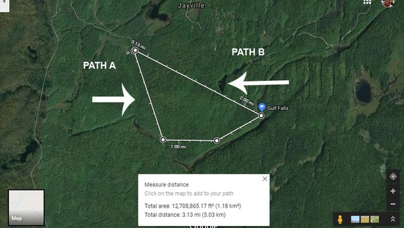
remnants of it through-out the woods. The first image
in the array is a map with the two paths taken that have
been used before.
Path A is wetter and along the
shore of Gulf Stream Valley. It is literally a boulder
crawl once you hit the water. Path B is a straight shot.
The terrain is really rough. It is up and down ridges
and rocks the entire trip with small valley swamps in
between. The undergrowth is very thick in here.
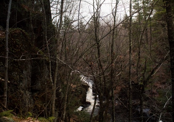
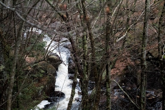
The Gulf Stream Valley itself is gorgeous. We did see a bear, and
heavy signs of bear within feet of the falls. The loose
boulder cliffs are easily 75 feet in spots. The falls are
in two sections. The upper is a rougher cascade, about
twelve to fifteen feet leveling off for about 30 feet
before hitting the second waterfall, closer to a ribbon
cascade, approximately 20 feet tall. The trail runs along
the left side of the falls.
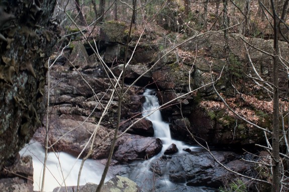
In the summer the lower
falls can be seen much better by crossing the stream or
climbing down. The weather and water levels prevented
us from getting a great view in spring.
The Gulf Stream flows into the Jenny Creek. This flows
into the Big Creek which continues into the West Branch of the Oswegatchie
River. This joins the main channel of the Oswegatchie near
the hamlet of Talcville in the town of Edwards. From here
it flows into the St. Lawrence River in Ogdensburg.
Last update: May 13, 2019
|