| Directions
Located on NYS Route 73, this site is just south of the
hamlet of Saint Huberts, which is on the stretch between
the village of Keene Valley and the northern intersection
of routes 73 and 9. Look for the signs for the Giant
Mountain Wilderness Area. The parking area for AMR
is directly across the road.
|
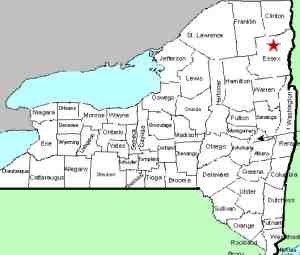
| County: |
Essex |
| Town: |
Keene |
| USGS Map: |
Mt Marcy |
| Waterway: |
Cascade Brook |
| Latitude: |
N 44° 07' 07" |
| Longitude: |
W 73° 49' 28" |
| Drop: |
150' |
| Type: |
Ribbon cascade |
| Region: |
Off NY 73 near the hamlet of St. Huberts |
| Parking: |
Unpaved lot |
| Trail type: |
Dirt/rock |
| Length of hike: |
0.8 miles beyond Beaver Meadows Falls |
| Difficulty: |
Intense |
| Accessibility: |
Access by easement |
| Name: |
Official |
|
First and foremost, this waterfall is located within the
Adirondack Mountain Reserve and, as such, is on private
property.
Access to it has been allowed by an easement agreement. It
has come to our attention that the owners of this land are
becoming increasingly annoyed by those who show up with
inadequate information trying to access it. It should be
noted that the listings for all of the locations within the AMR
have been on this website for well over ten years. We have
clearly stated the status of the locations here, including many
of the restrictions and conditions for access. In an
effort to reduce the increasing friction between the owners and
the public hikers, we are urging people to refer to our page for the general information on
The Adirondack
Mountain Reserve. It is one click and will only
take a minute or so to read, but it may save a significant
amount of grief to everyone involved.
Rainbow Falls is about 0.8 mile beyond Beaver Meadow Falls but
the hike will probably take you close to an hour. Whereas
the West River Trail up to this point has been well marked and well-worn,
that isn't always the case for some of the rest of the walk.
Most of this trail has been fairly close to the river, usually within
sight of it, but part of this portion veers away from the water.
There will be a few instances where you will wonder if you are still
on the trail. It isn't always obvious where the trail goes
and at times, the markers are few and far between. There is
a stretch of hundreds of yards where you are hiking along the base
of a sheer rock canyon wall. There are many places in the
Adirondacks more remote than where you are headed, but you are getting
there!
When you regain sight of the river, you actually find yourself
along a very calm stretch of the Ausable. It's almost like
you walked into another region. The last 3 miles of the Ausable
has been a constant drop, one waterfall or set of rapids after another,
with very few calm patches. The calm here is almost surreal.
It is also refreshing to realize that you are almost there!
Eventually you will see the dam at Lower Ausable Lake and a footbridge
over the Ausable before it. Veer to the right where you will
find another footbridge over the brook containing Rainbow Falls.
A sign on the other end of this footbridge points you to Rainbow
Falls, which is only 0.1 mile away. From this point, there
are actually a number of signs pointing you toward Rainbow.
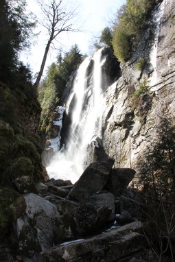
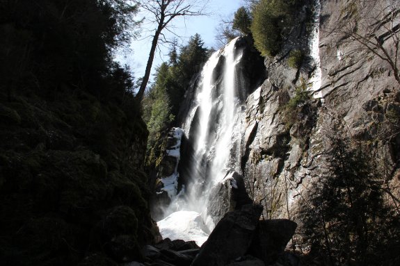
Rainbow is the most distant waterfall on the West River Trail,
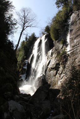
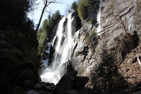
our fifth and final stop. This waterfall is quite beautiful.
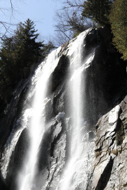
The water is pouring off the top of a sheer rock wall and does a
head-long free-fall for what is reported to be about 150 feet into
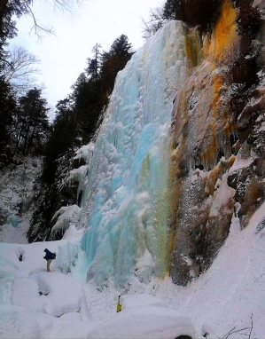
a pool in the canyon below. We were there in mid-spring and
really couldn't reach the base because there was still a lot of
snow and ice build-up.
After enjoying Rainbow Falls, you should re-trace your steps
to the dam and footbridge at the base of Lower Ausable Lake and
cross to the other side. You can either take a left at the
end of the bridge to access the East River Trail or climb the hill
to the Lake Road. The quickest and most direct path back to
your vehicle, or to the trailhead of Artists Falls, if you choose
to do that this trip, is to take the road.
one final note: Rainbow is actually the second most common
name of a waterfall in northern New York, behind High Falls.
Don't confuse this one with the other Rainbow Falls at
Ausable Chasm,
High Falls Gorge,
on the Chateaugay River,
on the Salmon River
and on the Grasse River
in the town of Clare.
The East Branch of the Ausable River joins forces with the west
branch downstream at Au Sable Forks to form the Ausable River.
This waterfall rich river empties into Lake Champlain in the town
of Peru.
Last update: May 29, 2020
|