| Directions
From the hamlet of Keene, just north of where NY Routes
73 and 9N split, take 73 north. Just before crossing
the river, the Hulls Falls Road will be on your left.
In about 0.4 mile, this waterfall will be visible on your
right.
|
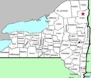
| County: |
Essex |
| Town: |
Keene |
| USGS Map: |
Keene Valley |
| Waterway: |
Ausable River East Branch |
| Latitude: |
N 44o 15'
02" |
| Longitude: |
W 73o 47'
52" |
| Type: |
Classical cascade |
| Drop: |
8' |
| Region: |
Southwest of Keene |
| Parking: |
Roadside |
| Trail type: |
NA |
| Length of hike: |
NA |
| Difficulty: |
NA |
| Accessibility: |
Unknown |
| Name: |
Common |
|
 This waterfall is about a mile downstream
from Hulls. On our first visit to this location, we
commented on the condition of the highway. The road
passing here is probably twenty feet or so above the level of
the river. The bank and roadway were caving in. Cement
barriers had been placed here and the northbound lane of the
road was closed. Stop signs had been placed at either end and
traffic was controlled on a "police yourself" basis. This waterfall is about a mile downstream
from Hulls. On our first visit to this location, we
commented on the condition of the highway. The road
passing here is probably twenty feet or so above the level of
the river. The bank and roadway were caving in. Cement
barriers had been placed here and the northbound lane of the
road was closed. Stop signs had been placed at either end and
traffic was controlled on a "police yourself" basis.
That has changed. On a visit in July 2017, we were greeted
with barriers completely blocking access. This is
currently a "double-dead-end" road. It does appear that
repairs are being made but we are not aware of specific details,
either regarding its current status or project completion date.
The land around this is posted but it is visible
from the highway. Even with that, we were told that it is a
popular local swimming hole.
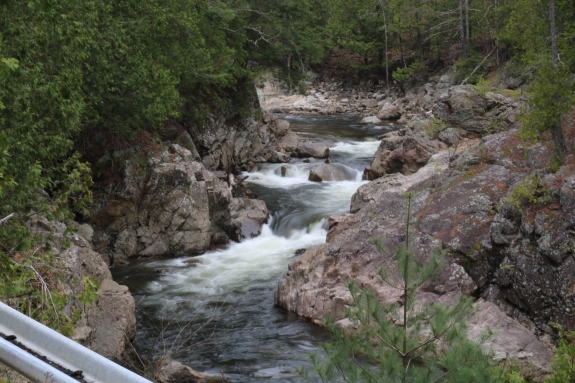
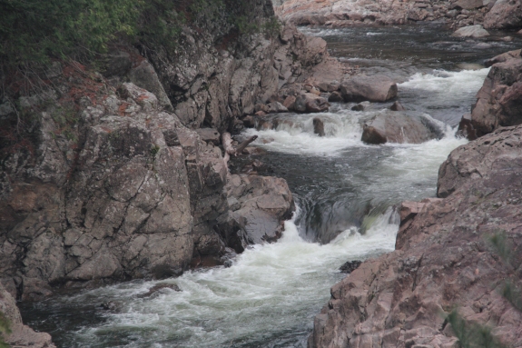
There are two sections here.
The top portion occurs in the middle of an "S" curve in the river.
There are two small drops followed by the mail plunge. After
another bend a hundred yards or so further downstream there is another
smaller drop. One word of caution about this location. You can see in
the first picture in our array that the guardrails are tipped over
to an almost horizontal orientation.The East Branch and the West Branch of the Ausable join forces
downstream at Au Sable Forks to form the Ausable River. This
waterfall rich river empties into Lake Champlain in the town of
Peru.
Latest update: August 18, 2017
|